

RRC has provided surveying for 85% of active midstream projects in TX & NM
Land Surveying
RRC provides a wide range of land surveying services, from commercial and industrial development and construction projects to oil and gas related surveys. We are currently authorized and registered to perform survey work in a number of states and continue to expand our offerings. All surveys are conducted under the direct supervision of our professional surveyors who have immense experience in the land surveying industry. Surveys are conducted using a combination of GPS and conventional systems.
Our capabilities include:
• 3D Scanning
• Pile Plot Plans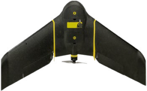
• Construction Staking
• Drone Surveying
• Geodetic Control
• American Land Title Association Survey (A.L.T.A.)
• Easement Survey
• Well Location Survey
• Topographic Survey
• Pipeline Right-of-Way Survey
• GPS/GIS Services
• Boundary & Lease Surveys
Professional Land Surveying is regulated by:
• Texas Board of Professional Land Surveyors
• New Mexico State Board of Licensure for Professional Engineers and Professional Surveyors
RRC RPLS are licensed in:
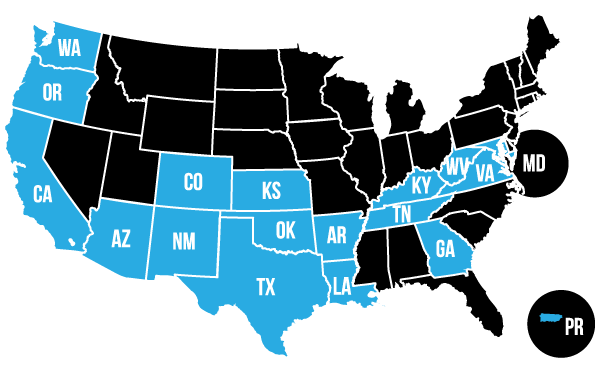
RRC Land Surveying Offices:
• Round Rock, TX Registration No. 10194422
• Midland, TX Registration No. 10193838
• Hobbs, NM Registration No. 4655451
Geodetic Control
A Geodetic Control is a professional land survey that establishes a network of horizontal and vertical control monuments for use in large design and construction projects. For example, when constructing a major site such as a wind farm, precise horizontal and vertical control throughout the project is required. The survey establishes numerous control monuments for reference and use by all contractors.
Certified Federal Surveyor (CFedS)
In August 2004, a Fiduciary Trust Model (FTM) was established by the Department of the Interior to simplify the delivery of accurate and reliable fiduciary trust services to eligible American Indian and Alaskan natives. A Certified Federal Surveyor is authorized to prepare certain portions of boundary evidence documentation using procedures detailed in the Department Manual 303 DM 7, Standards for Indian Trust Lands Boundary Evidence, as guidance.
This includes the preparation of certain portions of the following boundary evidence documents:
- A Land Description Review Certificate (LDR)
- A Chain of Survey Certificate (COS)
- A Certificate of Inspection and Possession (CIP)
- A Boundary Assurance Certificate (BAC)
The CFedS website can be found at http://cfeds.org/.
American Land Title Association Survey (A.L.T.A.)
An ALTA Survey is a land survey that meets land-surveying standards recognized nationally by title companies and lenders conducting real estate transactions. The survey shows the boundary along with easements (recorded and apparent), right-of-ways, improvements, flood zones, and other elements, which may affect the real estate transaction. For example, when purchasing a tract of land for a future refinery site, the lender and title company may require an A.L.T.A. survey as a requirement for the transaction.
Easement Surveys
By definition, Easement Surveys locate, on the ground, the limits of an existing easement or create a description for a proposed easement, such as pipeline right-of-ways, for recording in the County Clerk’s Office.
Well Location Survey
A Well Location Survey locates on the ground the location of a proposed oil, gas, or injection well and provides the necessary survey documents to file for a drilling permit.
Topographic Survey
Topographic Surveys combine improvement surveys with elevations and contours for site design purposes. They are typically ordered for design purposes in connection with site design, an engineering drainage study, or earthwork volume calculations.
Pipeline RIght-of-Way Survey
A survey that locates, on the ground, the centerline of a proposed pipeline right-of-way across an individual’s property depicting relevant topographic features such as fences and overhead power lines. The centerline is typically staked every two hundred feet. The survey plat contains a metes and bounds description of the proposed right-of-way for inclusion in the easement agreement.
GPS/GIS Services
Using global positioning systems, a GPS/GIS survey determines the location and relationship of existing topographic features for incorporation into geographic information systems. Typically used by government entities and to acquire data for interactive mapping. It is also used by corporations and oil production companies to map their infrastructure, such as pipeline systems, well locations, and production facilities for internal records management.
Boundary and Lease Surveys
A Boundary or Lease Survey establishes the legal boundary line of a parcel or lease on the ground and provides the necessary documents for the purchase and/or lease of the property. Typically, this type of survey is ordered when the location of the boundary lines need to be marked on the ground for future construction or to show interested parties the limits of the property.